The map room
Same coastlines. Different rules for putting them on a page.
Read the map
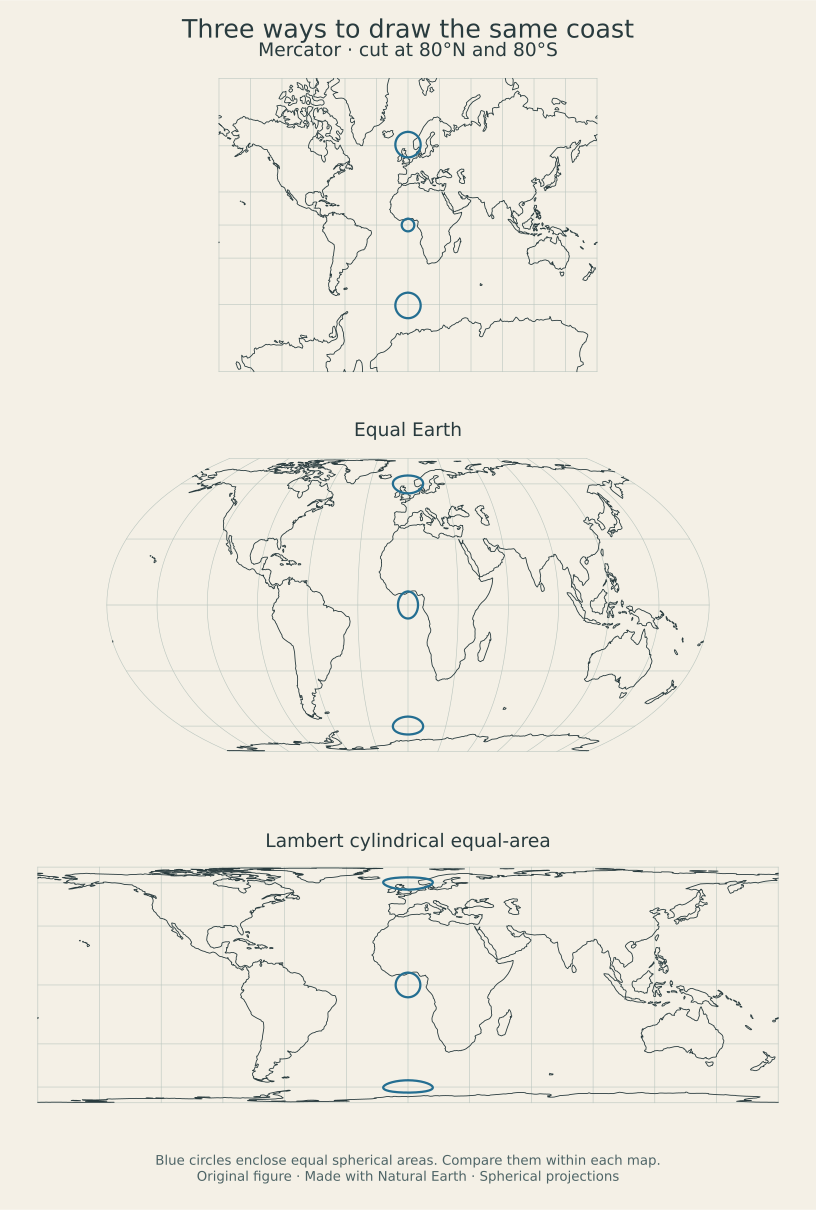
All three views use the same simplified Natural Earth coastline. The blue shapes are the boundaries of spherical caps with a 6° angular radius—equal-size circles on a globe. Their centers follow the chosen central meridian so all three remain visible.
Mercator preserves local angles while enlarging areas toward the poles. Its view is cut at 80° north and south because the poles lie infinitely far away. Equal Earth and Lambert cylindrical equal-area preserve relative area while changing shape; these views include the poles.
The reported area ratio compares the projected northern circle with the equatorial circle within the current view. Each outline is sampled at 180 intervals. It is a finite circle measurement, so Mercator’s ratio differs slightly from the fourfold local area scale at exactly 60°.
Center longitude moves the cut to the opposite side of the world. South at the top rotates the drawing by 180°; it does not reflect it. Equal Earth was developed by Bojan Šavrič, Tom Patterson and Bernhard Jenny in 2018.
These are spherical teaching maps, not survey or navigation charts. The coastline is generalized at 1:110 million and omits many small features. Its coordinates are plotted as spherical longitude and latitude. No locations are requested or tracked.
Download the code, data and checks · Static vector figure
Made with Natural Earth. Equations and source details are in the workbench.